Solitude, but Not Alone

Solitude, but Not Alone

Trying out a new way to post blogs, since I have so much trouble with the wordpress formatter. It will be interesting to see how it pans out with regard to SEO. To me, this manner lets me add more of a personal touch that I can tailor according to how much time I have. Hope you enjoy!

2014-3-29 Houda Point Post

Divergence

Following a predetermined course has its merits, but diverging has its opportunities.

Every summer, as the rainfall nears next to nothing, we watch the Mad River near our house sink. The mouth of the Mad River moves farther north, searching for an easy place to push through the sand dunes next to the Pacific. Generally, the river meanders in a northwesterly fashion until, within a quarter mile of the Pacific, it makes an abrupt and illogical 90 degree turn north-northeast to parallel the coast until it deems it time to exit into the ocean.  The heavy winter rains bring the mouth of the Mad back to the south, but I’m not sure if anyone has ever seen the river flow straight out into the ocean without making the 90 degree turn first. From aerial photographs, it looks like it has happened, just south of the Mad River Beach County Park, but otherwise the trees and higher dunes suggest it hasn’t happened anytime recently [maybe 1964? Or 1955?].
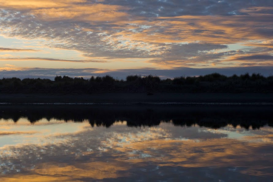
Mad River Sunset

The name of the river comes from a meandering man, Josiah Gregg, once a school teacher, doctor, business man, author, reporter, prospector, and naturalist, who didn’t seem to plan much out. At the age of twenty-four, he had already studied law and surveying and been a teacher. His doctor recommended he move from Missouri to New Mexico to be cured of those 1800s-style diseases that don’t like dry climates. Apparently, on that move, he got the wandering bug and never really sat still after that. No doubt, he probably saw more of the country [and Mexico] than most of us have. He was a business man for a while, then a practicing doctor for two years until he joined the California gold rush.
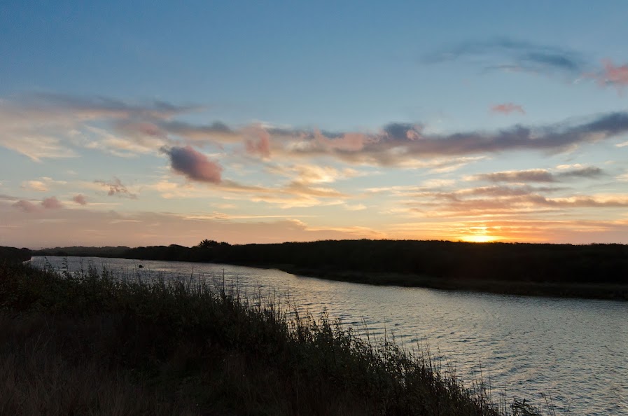
Mad River Sunset II


The mining party he led set out along a gnarly river then cut west to the redwoods, ignoring the advice of the tribe they came across [and stole food from] to take a trail to the coast. They made horridly slow progress through the forest at two miles a day [since Gregg was a naturalist and naturalists aren’t fast people], but reached the Pacific in a record six weeks [when it should have taken 8 days, according to locals]. The area wasn’t well mapped, so they were the first to find the largest bay in the region, Humboldt Bay, by land [in 1849!]. Apparently, Gregg’s crew got sick of him measuring and recording everything, so at the mouth of a river on the coast, they marched off while he measured the latitude. Once he caught back up with his party, he threw a fit. They agreed on one thing, to name the river the Mad River in honor of his temper tantrum.

Unfortunately, that wasn’t the worst part of the trip for Gregg, who died of starvation and fell off his horse before getting to San Francisco to report the location of the Bay. But thanks to his efforts, ships came up from San Francisco the next year to chart the Bay, and almost 50 species of plants are named in honor of Gregg. So imagine, if he and the Mad River had taken the straightest route, how different and lack-luster the story might have been!

Church Ruins? Yep, We Have Those!

While watching a show about local churches on ETV, they showed shots of ruins. Doing just a tiny bit of research led us to three easily accessible churches, each with a unique personality. Oddly, the stories of all three are very similar.

Biggin Church Ruins

Parrish Church of Saint John’s, these ruins are just outside Moncks Corner. With only two walls standing, and bricks falling out of those, these ruins aren’t the most unique, but the surrounding cemetery adds some interest. As the historic marker says, this church was built in 1712, burned by a forest fire in 1755, by the British Army in 1781, and again by a forest fire in 1886.

Pon Pon Chapel

Though not a church, the Pon Pon Chapel of Ease is found near Round O. The National Register states that the Chapel was established in 1725 and rebuilt in brick in 1754.  Sometime around 1801 the Chapel burnt, was rebuilt between 1819 to 1822, and again was ruined in 1832. Further damage was done in the 1950s due to a hurricane, after which stabilization was required.  The area is heading toward being overgrown and ironically there is a new interpretive sign propped up against the rusting steel gate.

Old Sheldon Church Ruins

This is by far the most impressive of the three ruins. Built sometime in the mid-1700s, it was burnt during the Revolutionary War. It is debated whether it was burnt by Sherman’s troops or just ransacked and later dismantled by nearby homes and plantations that were in desperate need of building materials after Sherman’s march. In contrast to the English bond style of Biggin and the Flemish bond of Pon Pon, these church ruins are in the Greek Revival style.  The grounds are well-kept, with large oaks looming. The graveyard surround the ruins are still used. There is a yearly service and a very large parking lot on the opposite side of the road.

Photo Gallery

If you visit:

Keep in mind that most of the cemeteries are still used or have members of families that still live nearby. Be respectful.

Mosquitoes are rampant.

The road to Pon Pon is not in best of shape. Drive carefully and watch for large trucks.

Leave everything where you found it. Even if there is a brick on the ground, it belongs on the ground where the church has stood for hundreds of years; not in your pocket or collection.

Driving Directions and More Information:

Biggin

Pon Pon Chapel

Sheldon

Stay tuned for the fourth ruin, St Helena!

Sepia Scenes Morris Island

First Sepia Scenes post from South Carolina!

Below is the Morris Island Lighthouse near Folly Beach just south of Charleston, SC.

At first, when I made this into a sepia, I wasn’t fond of it because it looks like the lighthouse is floating.  But considering its history, the floating lighthouse seems to capture the transient nature of this seemingly immoveable man-made monolith.

The first version of this lighthouse was constructed back in 1767.  A larger one replaced it in 1838, but it was later destroyed during the Civil War over fears that the Union would use it as a spy tower.  [Guess they weren’t worried about getting into the harbour safely?]

The current one was built in 1876 and was placed 1200 feet inland, but by 1938 it was already at the water’s edge.   Now, even at low tide, there are waves crashing around it threatening to topple it into the Atlantic. The lighthouse was decommissioned in 1962 and replaced by the more utilitarian Sullivan’s Island Lighthouse, seen below.

Currently, there are projects in the works to restore the lighthouse.  All info gleaned from www.SaveTheLight.com and I didn’t verify, so I have no responsibility for the information except reposting.  Hope you enjoyed!

For more Sepia Scenes, click HERE!

Thanks for visiting!